DAY 1
While looking for tracks and huts in the upper North
Island to walk I found this epic track and was surprised I hadn’t heard or
thought of it before. It is listed as a 4-6 day walk (though there were several
people doing it in 3 days) with 7 possible huts around. After checking out the
track times I found that to do it in four days takes one day of 11 hours, one
day of about 8 hours and two 5 and a half hour days. So with Easter coming up I
decided to start booking (for New Zealand Easter is a 4 day weekend with two
public holidays).
I could only find one person brave enough to walk with
me. We would drive down after work on Thursday, arriving at a backpackers next
to the Mountain around 10pm where we would be up and early to start walking at
7:30ish. I had decided we would walk anti clockwise (the opposite to what is
described on the
website since I was only able to book a campsite near the last
hut for that night. All other nights were fully book since that hut is also on the
northern circuit,
one of the 9 great walks of New Zealand so it was very busy.
 |
| From the backpackers in the Morning |
We parked up by the DoC office but couldn’t sign in until
8am so we finally started walking around 8:20. We made the decision to walk up
the Bruce road, as opposed to the Whakapapaiti track as it saved us a river
crossing and shaved off nearly an hour on what was to be our biggest day of
walking. I’m so glad we made that choice.
 |
| From the Bruce Road |
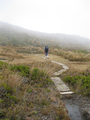
An hour up Bruce road we started the track, which was
really just a field of rocks, with poles marking the way. This was to be the
majority of the track. At this point I was again glad I had chosen to wear
shoes instead of
vibram 5 fingers. I felt far less ‘Paleo’ but I just wasn’t
going to be able to walk that kind of terrain with a heavy pack. I did however
have some injinji compression socks which were amazing. In under an hour we
reached the turn off to the Whakapapaiti hut which told us we had shaved off
nearly an hour taking this route. I plan on going pack and walking this track
at some stage.
 |
| The true start of the track |
 |
| An example of the majority of the track |
The next length of track was listed as 5 and a half hours
to the next track. We kept up a good pace over the ups and downs (the whole
half first two days was up and down) and would finally finish the track at
3:45pm which put us pretty much on track time. On the way it had started to
rain but not too badly and we heard some impressive thunder in the distance. At
around 2:30 we came to the large stair case down to Lake Surprise which was
quite a sight even in the rain. The river crossing to the hut was a little unnerving
for me, even though it was only knee deep its amazing how much pressure that
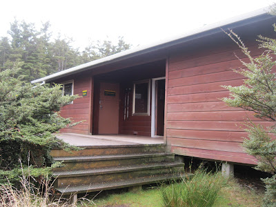
much water can put on you, and how freezing cold it is. The Mangaturuturu hut looked good,
and there was only 2 people in it at the time, but we made the decision to push
on to the next hut so that tomorrow didn’t have to be a 10-11 hour day. I was
told later that the hut filled up fast that night.
 |
| Down to Lake Surprise |
 |
| Mangatauruturu Hut |
The next track times were a little unclear but it was
listed as an hour and a half to the road and I had hoped it would be an easy
hike, it really was not. It started with another unnerving river crossing to a
massive climb before more ups and downs, it was a hard hike after already going
for 7 and a half hours. We must have reached the road at about 6pm. The walk
down the road from there was hard enough on sore tired legs, I had hoped we would
make it down in 30 minutes but it took twice that long.
So at 7pm we were off down the track to the next hut, we
made good time and started using our head lamps at about 7:45. The walk in the
dark was slow but not too difficult; the poles have reflectors on top making
them easy to spot in the dark. We got to the turn off at about 8pm and the last
half an hour felt like and age. Even the 300m after a sign which said 5 minutes
felt like 15 minutes. We finally got to the hut at 8:30 after 12 hours of
hiking. The hut was warm, and not full, but there were about 10 others there,
most already asleep. We made dinner as quickly and quietly as we could. It was
a struggle to eat much as we were both so tired but I got great nights sleep.
DAY 2
 |
| Walking away from Blyth |
At around 6am two people from the hut took off to make
for the summit of Mt Ruapehu, but we didn’t get up until around 7:30 and didn’t
leave the hut until 9. We reached the next hut after an easy two hours hiking
and had an early lunch. We also meet others walking the same section of walk as
us. We then headed off on what would be the hardest, but most beautiful section
of the walk. It’s a really shame that I didn’t get any photos of this section
due to rain. The first hour or so is in Beech forest before it changes to rock
fields, then more sections of decent and climb. Over this section of the walk
you gain around 200m of elevation. It was raining heavy and I was freezing cold
before we got to the last big decent and climb. I was able to get a hoodie on
and that held the cold at bay. After the gruelling climb out of the last major
valley, we still had another hour somewhat difficult hike ahead before the hut.
 |
| This is the only picture I took on the way to Rangipo |
We arrived at the packed Rangipo hut at 5:30PM. There
were people set up under leaking sections of roof and there was only one
mattress left, which we would have to share. The others on the section of bunks
kindly shuffled along to give us some extra room but we were defiantly in
cramped conditions. But the hut was warm, which was a relief after the last few
hours of cold and rain. Everyone was trying to dry clothes and the hut was
packed with sleeping, talking, cooking, people (I hope that grammar is correct)
but it was a great place to be. Everyone was down to earth and had stories of
all kinds of different hikes. This was probably my favourite hut, because of
the people and as weird as it is, because of the conditions as well.
Surprisingly everyone was in bed by 9 or 9:30.
DAY 3
 |
| From the hut in the morning |
 |
| Rangipo in the morning |
 |
| Walking away from my favorite hut |
A few groups were up at 6am but they ate and left quickly
with the plan to finish the hike that day. I was able to fall back asleep and
woke at 7:30 to a woman waking her sons up. We were able to get ready and leave
by 9am and started walking to the lahar danger zone. We made it safely through
this spectacular section of the hike, this is many peoples favourite area of
the walk. The next section of hike is some very easy desert plains before the
trail leads into a dry water course where it steadily drops altitude for an
hour or more. We made it to the Waihohonu hut by 2:30pm having had a very easy walk. We
set up our tents and relaxed that the hut. The hut which they called the palace
of the park, which was probably too flash for my liking, I much preferred the
worn out Rangipo hut.
 |
| Beautiful hiking near the lahar area |
|
|
|
 |
| Lahar danger area |
 |
| The last hour or more was a easy walk like this |
 |
| Waihohonu hut, the palace of the park |
At this hut there were groups from the round the mountain
walk and the ‘Northern Circuit’ which is one of the 9 great walks and is much
easier and more popular than the round the mountain track.
Now I don’t want to spend too much energy on this, but I
didn’t much like those walking the Northern Circuit. They were kind of stuck up
really, where as the round the mountain walkers were really down to earth. It
was things they said and the way they spoke, made me happier to talk to those
walking round the mountain. They seemed much more real, and were much more
outdoorsy.
I always have trouble sleeping in a tent, but I have a
bit more to say about that later.
 |
| A quick picture or our camp that night |
DAY 4
 |
| Mt Ngauruhoe from the Waihohonu hut |
We set our alarms for 6am so we could break our tents
down in the dark, have breakfast and head of that morning with the light at
7:30. This was by far the easiest day of hiking; we made a short side trip to
see the historic hut which was interesting, though it wasn’t so primitive when
compared to many huts currently in use. We also took a side trip to view the
lower Tama lake which was a sight to see, next time I will have to go further
up to the upper lake as well. I could barely keep my feet moving over the last
hour of more of this hike, despite it being the easiest day by far. I was just
worn down from the hours of hiking under such a heavy pack. We still made good
time and were back to the car just after 12 to start the long drive home.
 |
| Old Waihohonu hut |
 |
| Ruapehu from the track on the last day |
 |
| Lower Lama Lake |


