For part two click
here
For Part three, Gear, Click
here

In my search (in 2016) for multi day hikes in the upper North Island I came across the
North South track in the Kaimai Range. It was
listed as 7 days, but some of those days were as short at 2 and a half hours.
With a quick look over the track times I surmised it could be done in five days
with one or two days of camping. The only time I had to do a hike of this
length was in the Christmas and New Year holidays. This was in early 2016 so I
would have to wait almost a year to have the time for such a long hike. The
plan then was to do the hike the first week of the year, with whoever would
join me. I ended up with two friends who were willing. We started at the
southern end, as I prefer to be walking towards home.
There are a number of huts in the park ranging from 3
beds, to 26 beds; however most of these huts are at the northern end of the
park, while the southern end requires camping. I found some good suggesting for
track times, and day lengths on both the
Doc website and
NZ tramper website
however the track times did not quite match up. Due to this we would be doing
the hike with only ‘guidelines’ for how long each section would take us.
Day 1
 |
| Hurunui hut, stop for lunch |
The plan for the first day was to hike the last two days
suggested via the Doc website (they list the track as North to South, hence the
track name). This should have taken us 8.5 hours starting at the entrance to
the Kaimai Summit off State Highway 29. We meet at my house at 6:30am, and
started the 2 hour drive down, finally starting the hike at 8:40. The first
section started with a bit of a climb in altitude before an easy section to the
Hurunui hut. The track time was 2.5 hours to this hut which we pretty much
matched, then took an early lunch until 12. We made good time walking to the
next stop the Ngamuwahine shelter where we stopped for some more food. We made
it to the turn off for the Wairere falls by about 6pm. Most of the days walking
was fairly easy and covered in the bush the whole way. I don’t remember seeing
anyone else on this day.
 |
| Ngamuwahine shelter, stop for afternoon tea |
The difficulty of the day was that it rained all day
long. Walking in the rain isn’t so bad in and of its self, but it seems that
all roads lead to wet shorts. Water from you rain coat ends up there, so does
the water off you pack. It just ends up being 8-10 hours of walking around in
wet shorts.
 |
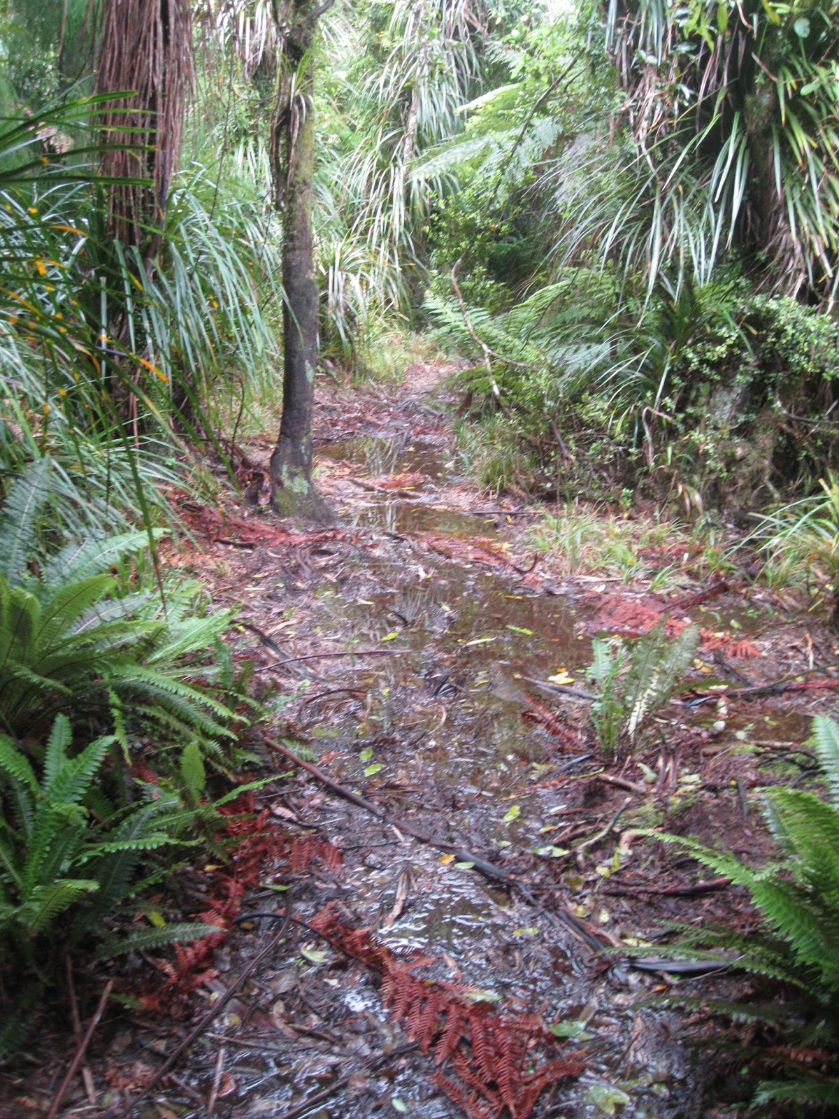
| Lots of mud |
 |
| And rough tracks |
About 5 minutes after the turn off for the Wairere falls
was a medium sized clearing, with a slightly larger clearing just behind it.
This is the area suggested for the second to last night of the North South
track, and the final destination for our first day or walking.
We set up camp here with some tarps we had carried and
some tarps we found in the clearing (more on our equipment will follow in another
post). It rained lightly throughout the night but we were able to set up a semi
comfortable area for cooking and sleeping.
 |
| Camp for night one |
 |
| Our little cooking area with tarps we found |
Day 2
Day two was to be possibly the hardest day of the trip.
It was set for 9 hours of some fairly rough terrain, and to top it all off, it
continued raining until lunch time.
We got up at 7am, and started packing up while cooking
breakfast (I’ll talk more about food in another post). We saw two hunters who
were up and about early and would see several more that day. We were able to
get everything packed away and we walking by 8:40. We ended up with about 8
hours of walking, which was faster than the DoC times, but slightly slower than
the NZ tramper times. The track was fairly rough, with a lot of wind fall
trees, however is was easy enough to find our way so the track was easier going
than the
Bell Track up Mt Pirongia. By the time we got to the turn off
for a hut we were all quite worn out so the prospect of an hour and a half of
climbing was not enticing. So, as much as we wanted to get dry and have a bed
to sleep in we chose to camp.
 |
| Very muddy |
 |
| Nice river crossings |
 |
| Still quite rough |
For most of the day all I wanted to do was to get dry,
everything was wet, and it was day two of walking in wet shorts, but it had
stopped raining after about lunch time, so by the time we set up camp things
weren’t so bad.
The clearing for camping was 10 minutes north of the turn
off for the hut. There was a large clearing then a much smaller clearing just
south of that (1 minute really). We chose the smaller clearing since it was
very windy and the smaller area was more sheltered, it also worked out well
that I discovered the long drop just off this clearing in the morning. The only
down side was there was no water to be found, I ended up taking a 30 minute
round trip in my jandals to get water (about 5 minutes south of the hut turn
off). We were able to set up quite a nice campsite for the night, but didn’t
really have anywhere comfortable to sit.
The night was quite cold, and I was probably at the limit
of my sleeping bag (summer weight) so clearly anything further south or later
in the season may require a warmer sleeping bag.
 |
| Camp for night two |
This day was physically much harder than the first day,
but I found it so much easier psychologically. On the first day I wondered what
I was doing and why (I could be at home, comfortable on my couch) but the
second day I could tell myself that this was the hard day, it would be followed
by two easy days, then the last day I would be walking home. This helped immensely.
Day 3
It was a bit of a cold start to the morning as the
weather had cleared up overnight to clear blue sky. We were up again at 7am,
and moving by 8:35. We saw a few more hunters this day. This day was some
fairly hard going again with quite a lot of up and down however the track was
pretty good all things considered. This day offered a lot more in the way of
views that the first two days. The first two days we trapped inside the bush,
by day three had several sections up high on a ridge where you could see out either
side of the range; however we had to pay for these views with plenty of walking
up hill. But this stage my knee was starting to get worn down, particularly
with eccentric loading, I suspect it comes from missing some range of motion in
that side ankle (broke it many years ago). I think I will invest in a walking
pole for longer hikes to take a little bit of the strain off that knee.
 |
| Great views |
 |
| We're heading over that |
We stopped at a nice little hunters hut with a great view
for lunch and it was great to take my shoes and socks off to get everything dry
after days spent in wet shoes. Not far from the hut we would stay the night at
we meet a large group who were walking the North South track in day walk
sections. Due to having to walk in and out of the range each time this would
take them 9 day trips, it would be a lot of doubling up for them, but a great
way to spend the summer. This is something that’s great about this track; there
are so many entry and exit points it makes the area so accessible, and
increases the safety level since help is so close by.
 |
| Motutapere Hut, stop for lunch |
 |
| The view from the hut |
 |
| Cool big steel ladder |
 |
| Tracks are getting easier |
We made pretty good time to the hut; however it was still
quite a hard day. There were enough people there to fill the hut, but a big
family group slept in tents outside. This section of the Ranges was still quite
rough, but had nicer tracks and huts, so while there were hunters further
south, we meet more seasoned hikers in this middle area. The next two days were
much more tourist friendly areas (with an overlap in the middle apparently
suited to nudists).
The Te Rereatukahai hut was quite a well maintained hut
and it was cool to hang out with other hikers and talk about the Range, what we
had coming up, as well as other hikes they had done.
 |
| Te Rereatukahai hut for the night |
Day 4
It was great to have a warm and comfortable night in a
hut (despite all the snoring), and an awesome start to that day that we could
pack up and eat our breakfast inside at a real table, it felt like luxury after
two nights of camping.
This was defiantly the easiest day with only about 6
hours of hiking, it was the shortest distance to walk, had the least climbing
and the track quality was way up. The only hard section was just after half way
(heading north) where there was about an hour of uphill climb. According to my
fitbit it was 70 flights of stairs in that section alone.
This day had some more varied terrain with some stuck in
the bush, some ridgeline sections, some along the river side, and some really
beautiful spots passing small water holes. It was great getting more variation
compared to the first two days.
 |
| Well maintained tracks |
 |
| Often following the river |
We got to the Waitawheta Hut at 3:30 and there was
already a number of families there and more showed up not long after to give us
an almost full hut. This section of the range was much more accessible with
easier and more maintained tracks so there were more touristy people than the
hikers for the last hut.
Despite this having been an easy day we were all starting
to get worn down so it was great to just relax in the hut. Bags were getting
much lighter too so that helped.
 |
| Waitawheta Hut for the night |
Day 5
We had to get up at 6 and got moving just after 7am as
there was a possibility of 10 hours of hiking ahead of us. Both Doc and NZ
tramper had the walk to the next hut listed at 4.5 hours, then Karangahake
Gorge as 5.5 hours from there, however the sign at the Waitawheta Hut had the
walk listed as 3 hours to Dalys Hut. I find these signs are generally right on
time when hiking with a heavy pack so I was fairly confident we would get to
the Gorge before 5pm.
 |
| Easy going |
 |
| Great views |
 |
| There are about 10 of these bridges |
The walk to Dalys hut was really easy, with most of it
being old tramway, there was only a short stretch of hut hill 20-30 flights of
stairs (according to fitbit). We made it to the hut in 2.5 hours so well ahead
of the track times and feeling pretty good. The hut was really cool, quite old
with a new funky paint job but had everything a hut needs inside; I will try to
make a trip back to stay here at some point.
 |
| Dalys Hut |
 |
| Regrowth of Kauri trees |
The next section to Dickies flat were well maintained
tracks, easy going with some nice views, particularly alongside the river.
However things got a bit tricky when we got to Dickies Flat. The map wasn’t
quite large enough for a good indication of which direction to go, and there
didn’t appear to be a sign post for the Gorge, but after a few false starts we
found out way. This section was very well maintained (almost wheel chair
friendly) and went along side the river to a tunnel which was quite cool and
even included some glow worms. The easy track continued past the tunnel which a
short section of stairs up to the windows walk. This is a short walk in tunnels
with beautiful views out the windows (cut as exit points for the material
removed when tunnelling) only 20 minute from the Gorge.
 |
| Looking out one of the windows |
This was truly the final stretch, to civilisation, or a
car park full of people that is.
 |
| From the look out. |
Final thoughts
While I enjoyed this walk and would certainly come back
to hike different sections, I don’t think I would hike the north south again.
For me it was too much time stuck under the canopy without views, and not
enough varied terrain for me. I’m happy to have done it, and would suggest it
to others, but maybe not a round 2.